
识别城市中心是研究和规划城市空间结构基础和前提,因此识别方法十分重要。
广为采用的中心识别方法包括:
(1)密度阈值法
(2)局部加权回归 + 残差分析法(McMillen, 2001)
(3)空间统计法(LISA等)
这些方法在适用数据、识别效果等方面存在一定问题。
我们提出新的中心识别方法——LDM。
为了验证新方法的有效性,我们开展了基于Monte-Carlo数值模拟和实际数据应用的检验。
Identifying urban centers is crucial for understanding urban spatial structures. Conventional identification methods include:
(1) Density threshold,
(2) Locally weighting regression and residual analysis,
(3) Spatial statistics (e.g., LISA)
But these methods have their own inadequacies.
We proposed a new approach, the Locally Decaying Model (LDM). We compared it with conventional methods by Monte-Carlo simulation and real data experiments.
数值模拟 Monte-Carlo simulation
评价识别方法的难点在于,世界上不存在客观的 “城市中心”,所有的城市中心都取决于研究者的定义。因此在实际数据上,我们很难客观的评价不同方法的优劣。
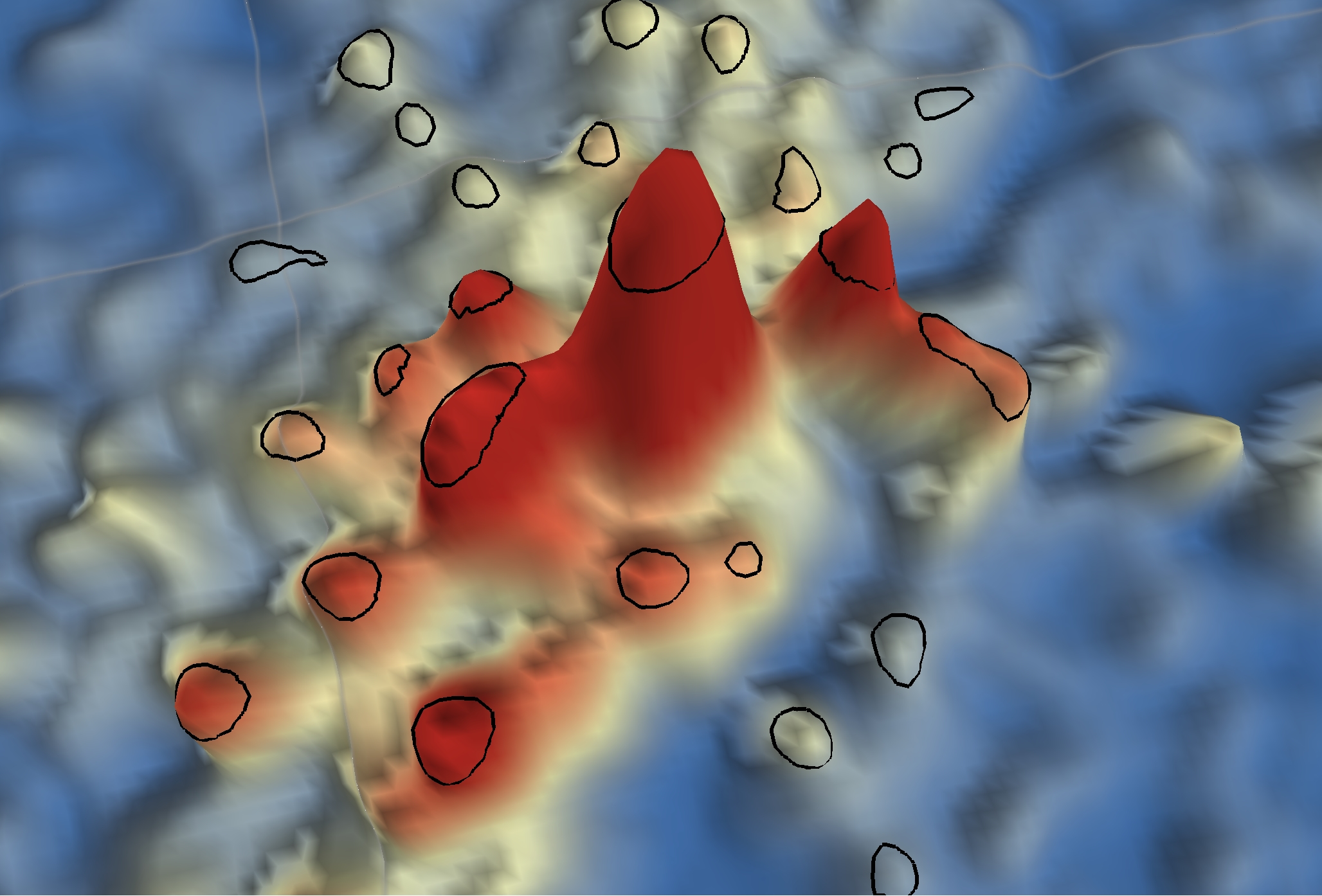
我们提出一种巧妙的验证方式。首先生成无数个 “一主四副” 的虚拟城市,所有中心都是给定的,然后测试不同方法识别中心的精度。
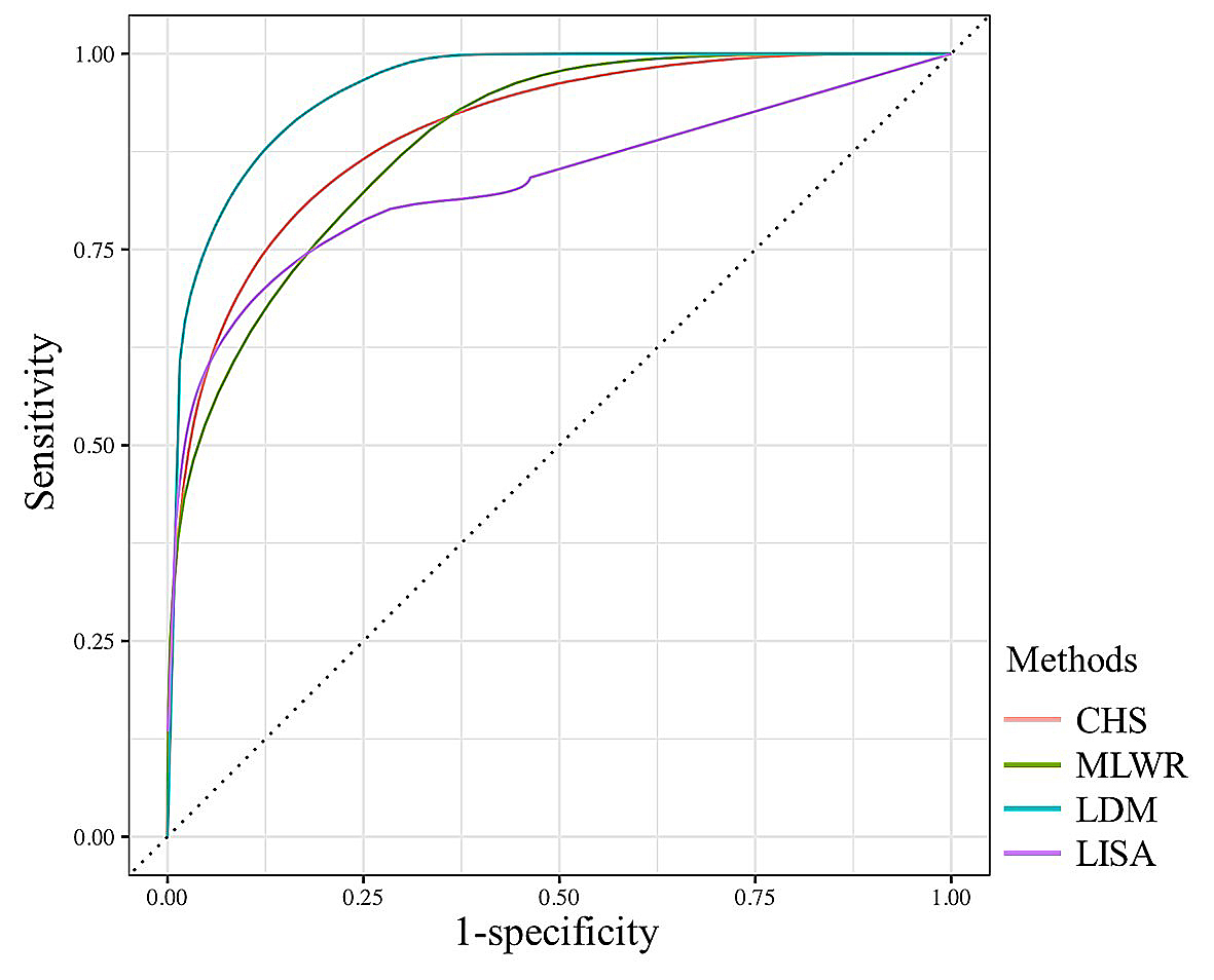
ROC结果图表明,LDM非常好的识别出了中心,准确度超过所有传统方法。
The difficulty of evaluating identification methods is that there is no true “urban center”, and all centers depend on the researchers’ definition.
We propose an ingenious way. First, many virtual cities are generated each with four given sub-centers. Then, the accuracy of different methods are evaluated.
The ROC curves indicate that the LDM performed significantly better than conventional methods.
实际数据应用 Real data experiments
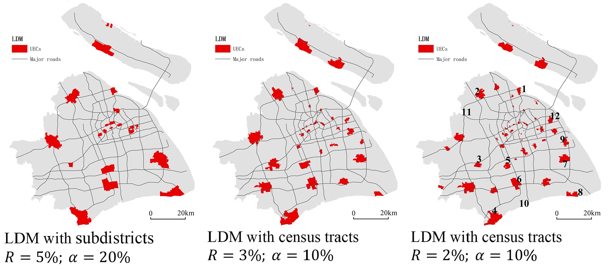
我们继续比较LDM和其他方法在各类实际数据上的适用性,包括街镇单元、居委单元、栅格数据。
结果表明LDM适用于各类分析单元,并且在识别结果上表现出最好的连贯性,以及与规划分析需求的协调度。
您可以下载为ArcGIS Pro设计的中心识别工具,并尝试采用它识别各种类型和各个级别的城市中心。
The methods are compared on various realistic data, including town, census units, and raster data. The results show that LDM has the best consistency in identifications and well matched with planning analysis requirements.
You can download the LDM tool designed for ArcGIS Pro and try it on various types of data.
Download:
A tool of LDM, designed for ArcGIS Pro 3.0 version.